Wet with mud and rain, sliding down the mountain using my butt and palms, I wondered, briefly, why I even signed up for this.
Compared to Mt. Pinatubo, the climb to Pico de Loro was harrowing. I had a scary moment when I had to sit because I couldn’t catch my breath and I could already see black spots in front of my eyes. The muscles near my right kneecap cramped up on the return trek – a new pain, so new that it took me a while before I realized I was already having cramps. It rained while we were on the summit, and on the way down I slipped and fell in the mud more than twice. Four days after the hike I still find it hard to bend my knees. Perfect for newbie mountaineers, my foot!
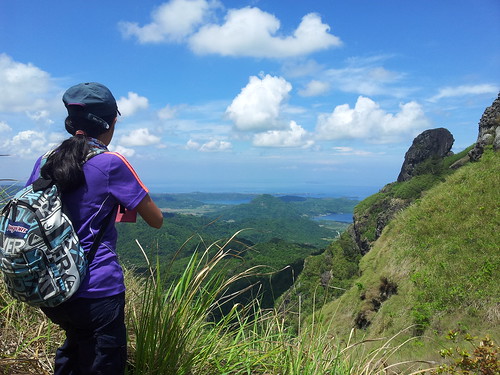
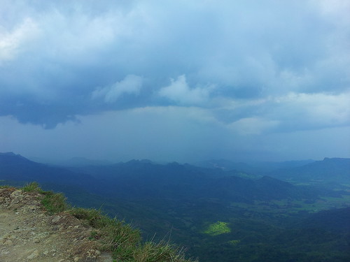
BUT I was glad I went ahead and discovered that I could survive such a crazy trek. While on the summit we spotted rain in the distance, and saw black rain clouds rise up around the summit like smoke. We saw dragonflies flying more than 600 meters above sea level. I heard complex bird calls I’ve never heard anywhere before. And the most amazing thing was the entire week before the trek I was worried I would be a burden to strangers, but it turned out that Bebang Siy’s husband, Poy, was there with his sister, Rianne — so I became a burden to people I sort-of know! Pwede na rin! Haha! Thanks to these two, otherwise I would have been found crying in an ant-infested corner of the trail.
My thanks once again to Travel Factor, especially to sweeper Fonci Patricio. Syempre sa sobrang bagal ko sweeper na ang kadaldalan ko pabalik. Kalurkey.
Great trip! The pain was worth it.
PICO DE LORO
Maragondon, Cavite and Nasugbu, Batangas
Major jump-off: Magnetic Hill, Ternate, Cavite
Minor jump-off: Ternate-Nasugbu Highway, Nasugbu, Batangas
LLA: 14° 12.855 N; 120° 38.785 E; 664 MASL
Days required / Hours to summit: 1-2 days / 2-5 hours
Specs: Minor climb, Difficulty 3/9, Trail class 1-3
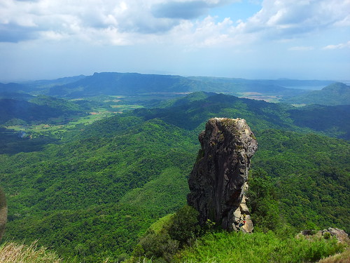
Features: Distinctive spire at the summit, forests, scenic views of Cavite
Source: http://www.pinoymountaineer.com/2007/08/mt-palay-palaypico-de-loro-664_9808.html
ITINERARY
04:00 Meet-up at designated location in Ortigas area
04:30 ETD Ortigas
07:30 ETA Ternate Cavite, eat breakfast snacks
08:00 Registration, Start of trek
11:30 Arrive at summit!
12:00 Lunch
13:30 Start of descent
14:30 Sidetrip to the falls
15:00 Resume descent
17:00 Arrive at jump-off point, wash up
17:30 ETD Ternate, Cavite
20:30 ETA Ortigas
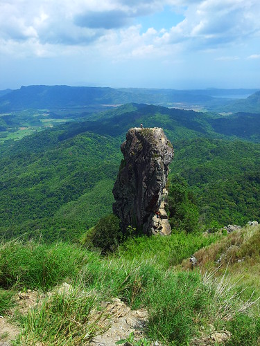
PS I didn’t go to the monolith because damn are you crazy
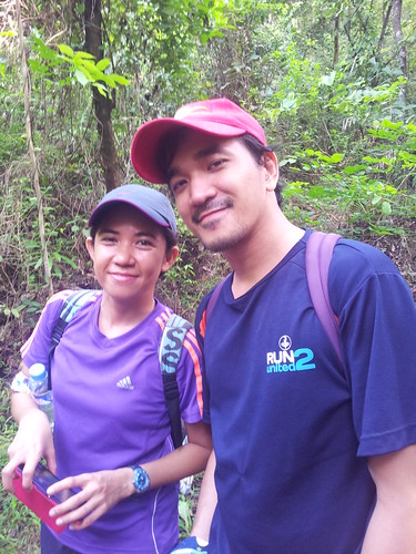
Poy and Rianne:
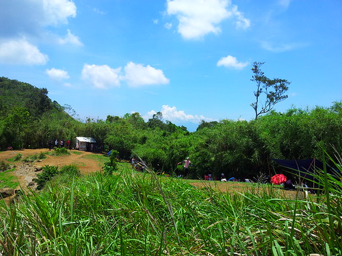
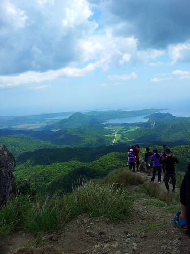
It was a big group, 64 in all:


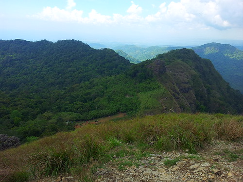
Some of us took the wrong trail and ended up on the other side of the campsite. Oops. But it was a great view:
We had to loop back and go through thick clumps of bamboo.
Campsite for lunch.

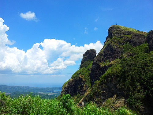
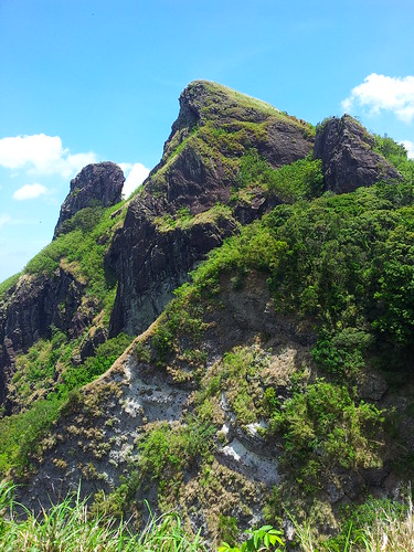
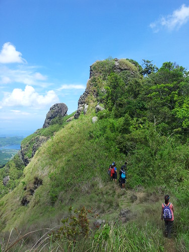
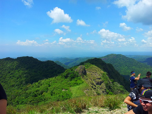
To the summit!

Corregidor in the distance.

Hamilo Coast?
 The monolith.

Look at that striking white line of a road:
Here comes the rain.
The campsite from above.
I was told the Pico de Loro trail, though covered and cool, was harder than the Mt. Pulag Ambangeg trail. Well, damn. I guess I’m going to Pulag next? :)


